- 3D Indoor Mapping
- Automatic step by step guidance (proprietary system)
- Automatic follow-up of patients
- Staff protection in healthcare facilities
- Equipment geolocation in healthcare facilities
- Customized mobile app
- Mobile content management platform
- Expert advice and support for local authorities’ digital projects
- Access to real-time statistics
- Website creation
In order to provide indoor geolocation services, companies like Sweepin have to rely on 3D mapping of an establishment's buildings.
3D mapping, the basis of indoor geolocation
3D mapping of a building is a detailed representation of its structure, offering a realistic and comprehensive perspective. Drawing up a 3D plan enables you to visualize the height, shape and layout of a building's different levels.
A connection can be made to the Digital Twin to facilitate the creation and updating of a building's cartography. The Digital Twin is a real-time virtual reconstruction of a physical object or process, used to simulate, monitor and optimize its operation. In particular, this system enables more efficient resource management by simulating different layouts and space configurations to optimize plant utilization. It also enables proposed changes to be simulated and evaluated to minimize errors and costs.
Over time, the buildings of a facility, such as a hospital, are bound to evolve, be redeveloped or even restructured. Their mapping then needs to be updated to provide a consistently accurate map for geolocation services.
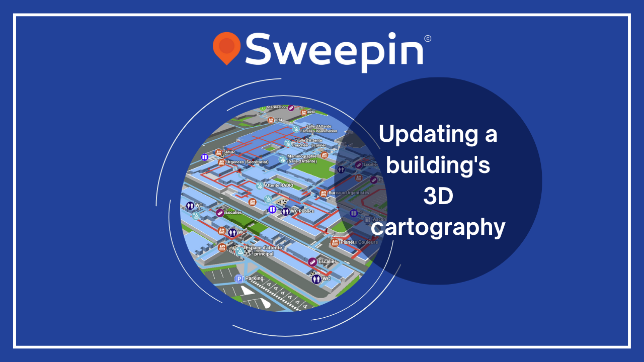
Quick and easy updating of building plans with intuitive tools
Updating a building's cartography can seem tedious if it includes a lot of changes. It's up to companies like Sweepin to make updating easier, especially when the changes don't affect the building's architecture.
Once the first 3D map has been created from the architect's plans, various elements of the plan, such as style, access features and points of interest, can be easily modified. Easy-to-use tools make it possible to quickly update all these mapping elements without calling in the professionals.
The flexibility offered by these tools guarantees an accurate, up-to-date representation of the environment. In this way, the building's functional evolutions are taken into account over time. This proactive approach to updating mapping contributes to efficient space management and optimal use of resources, particularly in facilities such as hospitals.
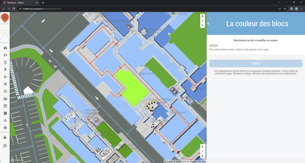
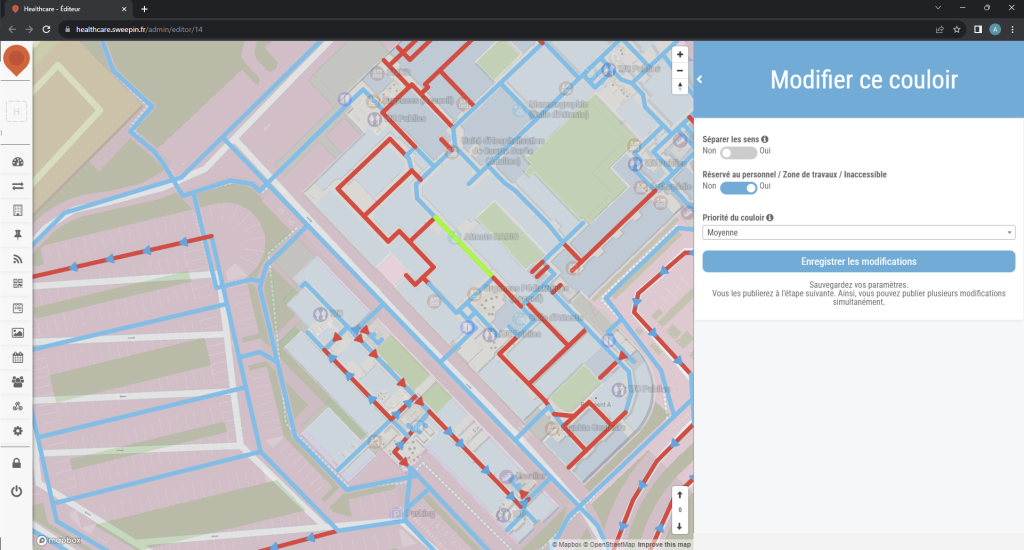
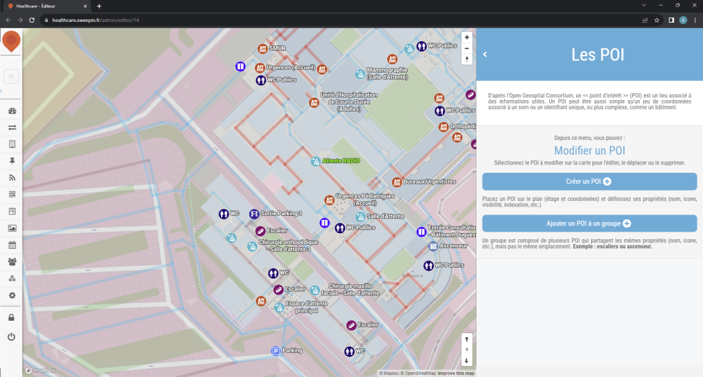
The case of Sweepin and its 3D plan editor
Sweepin uses the Digital Twin to provide its customers with their digital cartography. In addition to this, a 3D plan editor is entirely dedicated to the company's healthcare facility customers. This editor is easily accessible by any facility wishing to update its 3D mapping. It provides a range of features to give healthcare facilities control over certain elements of their cartography whenever they wish. The interface is intuitive and fluid, and each tool is clearly identified to simplify the updating process as much as possible.
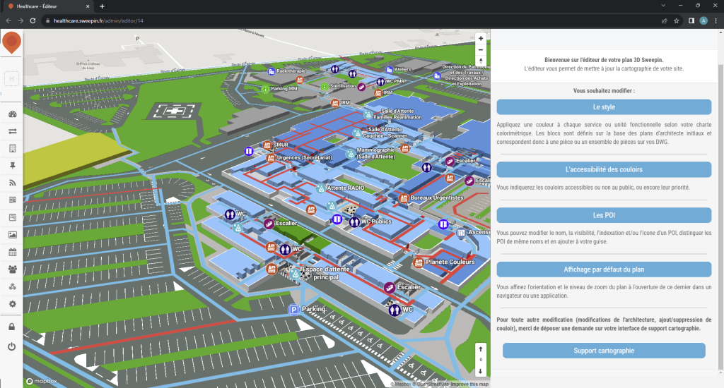
The style of a building can be easily modified, including its color. Changing the color helps to distinguish each department of a healthcare facility. It can be changed at will, but always strategically, especially when a department moves from one building to another.
If required, it is also possible to quickly and easily change the accessibility of a building's corridors, by defining their priority and whether or not the public can use them. This can be useful for managing the flow of people through the building, or for preventing certain areas from becoming congested in an emergency.
Finally, it is also possible to add, modify or delete points of interest in a building, in case some of them change location or are removed during relocations.
Major modifications, particularly to the building's architecture, can be carried out either via an automatic update of the Digital Twin, or by specialists due to their technical complexity and the time required to carry them out.
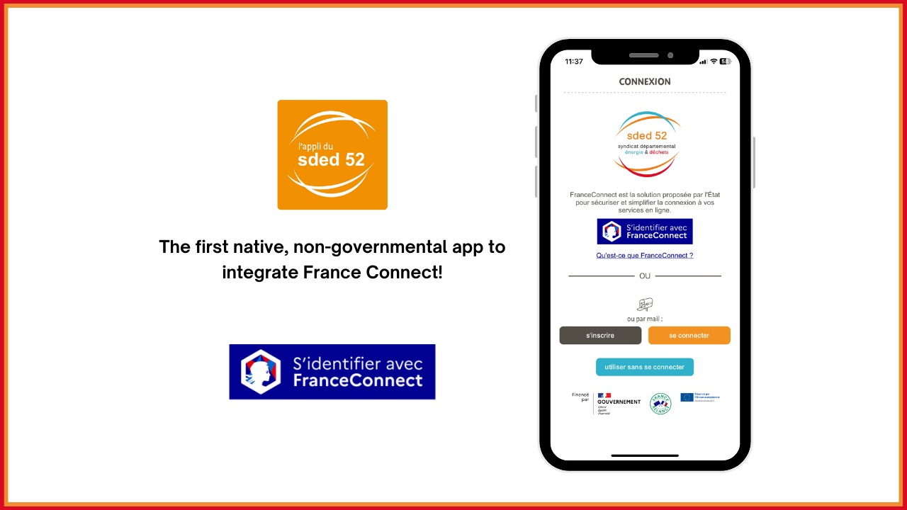
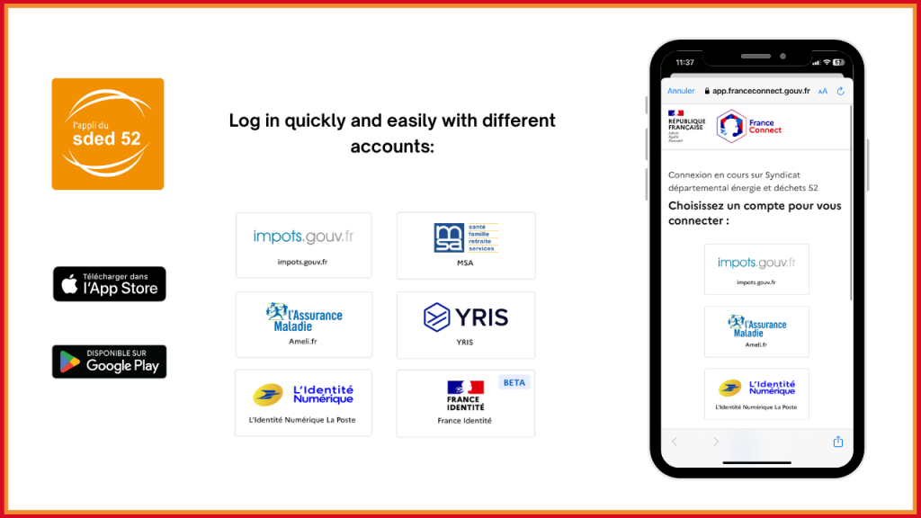
💡SDED 52, the Syndicat Départemental de l'Énergie et des Déchets de Haute-Marne application made in Sweepin is, to date, the first native non-governmental application to have integrated connection with France Connect!
✅This login system simplifies access to online services, saving time for users, who can use different accounts to log in:
- Impots.gouv.fr
- MSA
- Ameli.fr
- Yris
- L'identité Numérique La Poste
- France Identité
This universal authentication saves time and strengthens user account security.
Find the app on iOS and Android stores now!
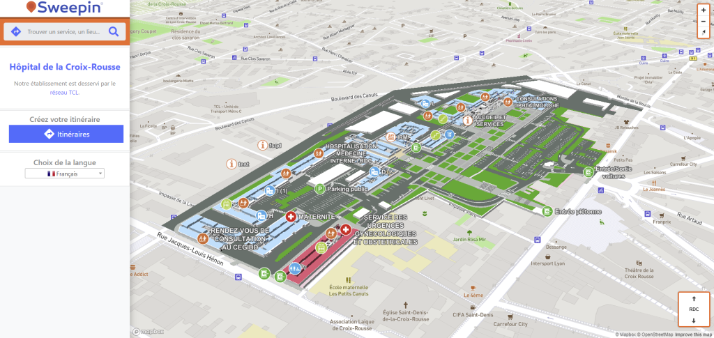
Hospices Civils de Lyon has launched its new interior guidance system for patients and visitors to its facilities.
🧭This solution, provided by Sweepin, makes it easier to get around the Hospices Civils de Lyon by offering web guidance based on 3D mapping of hospital buildings. Maps are accessible on the HCL website, enabling patients to plan their route from home.
📱On-site, patients and visitors can scan QR codes to obtain a personalized itinerary, adjustable to their walking pace. Convocations also include QR codes linked to the hospital facility.
✅This device improves orientation, saves time, optimizes queues, and is suitable for people with reduced mobility, the visually impaired and the hard of hearing, thanks to audio and visual instructions.
The Sweepin team would like to thank the Hospices Civils de Lyon for their confidence in this project, which contributes to improving the day-to-day patient experience.
Example of a map¹ and itinerary generated² in the Croix-Rousse Hospital: